Walk the Walk

‘Paths are not just means of traversing space, but also of feeling, knowing and thinking.’

From the foreword by Robert Macfarlane in The Old Ways, A Journey on Foot


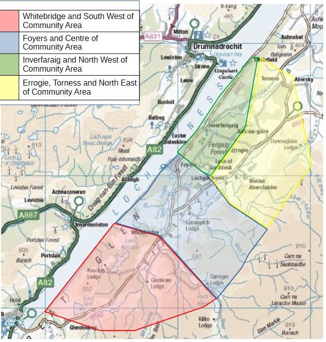
We are incredibly fortunate to have a huge network of paths in our area. The South Loch Ness Trail runs through the area but there is also a network of paths, some fairly well known, but others, which are less well known, perhaps not way marked and a little more off the beaten track.  To encourage both locals and visitors to get out, explore, and have your own adventures, the pathways group have mapped and described a range of walks.

We will continue to add walks to the list below and if you are out on one of these walks and you find a shortcut or perhaps a variation that you think is better, please do let us know (and send us pics if you can!) Or, if you have your own favourite walks, get in touch and we can map them for you. Some of the best walks we have are those where literally you can’t see ‘the wood for the trees’.


Hillwalking during the deer stalking season? A link to help you find out where deer stalking is happening. 


LIST OF WALKS

Whitebridge - Foyers

Reservoir Walk, Foyers 

Lochan Tor an Tuill circular from Inverfarigaig

Inverfarigaig circular via Glen Liath

Loch Ness and the Falls of Foyers

Inverfarigaig to Foyers, South Loch Ness Trail
Drummond Woods, Whitebridge

Foyers Bay Circular North

Foyers Circular including Upper Falls


Wester Abercalder to Garthbeg 
   

The link under each walk summary can be opened in the OS (Ordnance Survey) Maps app which is available to download free of charge.  You can then follow the walk described and be confident you are not going off route at any time.


Wester Abercalder to Garthbeg 

7 miles - out and return. Easy flat walking on a small section of road, track then grassy track along the south east side of Loch Mhor. The walk follows a small section of the Trail of the Seven Lochs. 

https://explore.osmaps.com/route/19155488/wester-abercalder-to-garthbeg


Description

Parking is very limited at the start of the walk. Please choose a spot where you will not restrict access for either residents or farm vehicles. 


From the farmyard at Wester Abercalder, follow the tarred road to your right. After a short distance this changes to a gravel track all the way to Migovie. At Migovie, keep to the left of the house and look out for a Trail of the Seven Lochs marker post. Follow this grassy track all the way to Garthbeg or for as long as you want before retracing your steps back to your car. Enjoy  the views across Loch Mhor to Gorthleck and if you are fortunate, you may see red kites flying above. If you are interested in archaeology, there are a number of hut circles close to the route. 


Foyers Bay Circular North

A very easy flat route of approximately .75 of a mile round the North Shore of Foyers Bay

https://explore.osmaps.com/route/19021748/foyers-bay-circular-north


Description

The walk starts at the old aluminium factory in Lower Foyers. If arriving by car, park in the rough ground opposite the factory.

Walk along the road with the factory on your right and to the end of the boat yard. Look for the gap in the fence signposted Foyers Recreational area. Go through the gap and head towards the loch, bearing slightly left and you will see a small wooden footbridge. Go over the bridge and follow the rough track. Part way round you will come to a small shingle beach which offers spectacular views down the loch. When you get to a small T junction, turn left, and the path continues with the River Foyers on your right until you reach the road. At the road turn left and follow it back to the start.


Inverfarigaig to Foyers, South Loch Ness Trail

3.2 miles, moderate

This walk follows a short section of the South Loch Ness Trail from Inverfarigaig to Foyers.

https://explore.osmaps.com/route/18306163/inverfarigaig-to-foyers-south-loch-ness-trail


Description

Start the walk at the Farigaig car park. There is a short steep uphill section to begin but turn right after about 50 metres to follow a small track to a viewpoint overlooking Loch Ness. If you are into Geocaching, you may want to search out the cache near here! Follow the route back down to the main forestry track. Turn right and look out for the blue marker posts with a squirrel which are the official signs for the South Loch Ness trail. When you reach the large pylons, it is worth making a very short diversion to the right to get views down to Foyers Bay. Continue on the forestry track, keeping left at a signpost marked for Easter Boleskine. Follow the track uphill, again, looking out for the blue marker posts. Keep straight ahead when you see a track on the left and follow this next section, which can be pretty boggy, up into the trees.


Again look out for blue marker posts and be careful when you come to the chain to help you over a short rocky section. The track continues to wind uphill. Unfortunately, most of the views of Loch Ness have been obscured by trees, but there are a few big flat rocks which you can scramble onto for a peek at the loch or just sit and relax after the exertion of climbing to the highest point. The track now heads downhill, and after hopping across a wee burn, you come to a main forestry track again. Turn right here and follow this track all the way down to the main road B862. Be sure to look out for the shaft at a small clearing. This is a service tunnel of the Foyers Pump Storage Hydro scheme.

Turn left at the road and following the pavement, walk up the short sharp incline to the shop/car park at Foyers.     


Inverfarigaig circular via Glen Liath

4.65 miles. Mostly easy, some road walking, with a couple of moderate sections

https://explore.osmaps.com/route/18306821/inverfarigaig-circular-via-glen-liath


Description

Start the walk at the Farigaig car park.

From the car park, turn right along the road. Look out for the memorial to geologist James Bryce.  Continue along the road and at the bridge, keep to the right along Glen Liath and look out for a Right of Way marker – Footpath to Aultnagoire and Stratherrick.

Take this track and follow an old but well defined path uphill until you reach a forestry road.

Turn right here and follow the road until it splits.

Keep to the right and look out for a Trail of the Seven Lochs blue marker post on your right. Take this small track which begins to head downhill and reaches the road again. At the road, turn right and you will reach a large turning area/forestry track. Look out for another Right of Way marker – Foyers via hill route, Inverfarigaig via Boleskine and take this track which initially goes fairly steeply uphill.

After a short distance you will come to a wider track with a blue South Loch Ness marker post and Forestry Finger Post. Turn right here, following the track which, after a short way, begins to head downhill. Keep to the right, following the blue markers until you are close to the car park. If you wish, you can follow a short loop to a lovely bench with views over Loch Ness.

If you are interested in Geocaching, you may want to search out the cache near here! Follow the track past the bench, heading steeply downhill to the car park.


Reservoir Walk, Foyers 

Distance – 1.5 miles.  A short circular walk to the old reservoir behind Foyers.  A steep section up through the trees, and care needs to be taken when heading downhill back to the farm track at Glenlia.  Easy/Moderate.

https://explore.osmaps.com/route/18798799/foyers-reservoir-circular


Description

Start at the car park at Foyers Stores and take the main road towards Inverfarigaig.  Turn right up towards the school and follow the hill route to Inverfarigaig and Boleskine.  At the gate, take the small track heading uphill.  Just after two old tree stumps, take the route to the right, not uphill to the left. 

Soon you will see the marker posts.  Follow these uphill and then along the side of the reservoir.  At the end of the reservoir, there is another marker post with a path leading to the left.  Don’t take this immediately but follow the path you are on round to a large rock.  If you are lucky and it is a still day, there will be wonderful reflections of the trees on the opposite bank in the water. 

Retrace your steps and take the track at the marker post down through the trees where you will meet a vehicular track.  Turn right here and follow this back towards Foyers, keeping left at the houses at Glen Liath.  At the main road beside the playpark, turn right and return to the car park. 


Foyers Circular including Upper Falls

Distance – 4 miles 

A circular walk taking in both the upper and lower Falls of Foyers as well as the loch shore. Care should be taken on the narrow path after the Jane Fraser Memorial. Some climbing, especially up to the Lower Falls. 

https://explore.osmaps.com/route/19123844/foyers-circular


Description

From the Upper Foyers car park beside Foyers Stores and Waterfall Cafe, turn left towards Whitebridge. 

Turn right at the Waterfall Cafe sign and follow the track to the narrow bridge. Stop here and have a look at the upper Falls of Foyers. 

Continue over the bridge and take the track along the side of the fields. At the end of the fields, where the track splits, follow it up to the right (the left hand fork takes you to Whitebridge). The track rises for around quarter of a mile then it begins to go downhill again. Just past a bench, (which used to have wonderful views of Foyers Bay!) take a left along a smaller, grassy path. Go through the gate and, without turning left or right, cross straight over the field downhill towards a gap in the tree-line. Climb over the fence and follow the path through the woods and to the right towards the drive leading into Foyers cemetery. Turn left along this drive, go into the cemetery and then to your right, take the gate out of the cemetery. Head right towards the Jane Fraser memorial. Walk round the memorial, following a narrow path which will lead you down to the Loch shore. The Loch will be on your left. At the campsite follow the road up to the Bailey bridge and turn left across the bridge, following the road round as it goes towards upper Foyers. Take a right (opposite the Health Centre) where it is signed for Foyers Bay house and Foyers lodges. 

Just at the entrance to Foyers Bay house, there is a track to the right. This track, which is steep in places, will lead you up through the woods with views of The Fall of Foyers and eventually to the main road, Foyers Stores and the car park. 


Drummond Woods, Whitebridge

Distance - 2.6km circular route 

This one is no doubt a well-travelled and well-known circular route that picks up an easy trail into Drummond Woods, Whitebridge.  It is just along from the Whitebridge Hotel so grab a pre or post refreshment from the lovely team there! 

Parking is a little limited, but the trail is good for all, just mind the last little drop downhill as it takes you under some low branches. 

https://explore.osmaps.com/route/18701545/drummond-woods-whitebridge


Description 

Park up just at the entrance (parking only for 1 car) or a suitable place along the road.  Head off through the forestry gate and take the path straight ahead.  Follow the path in an anti clockwise direction which meanders round on a level wide pathway suitable for walkers, bikes and horses! 

As you complete the circuit in the last third, watch out for the low branches as you drop down the hill especially if on horseback! 

Keep your eyes peeled for deer, red kites, golden eagles and native woodlands, if you extend your walk to Loch Kemp. 

Once complete, you can treat yourself to a coffee, cake or something stronger at the Whitebridge Hotel…just a few strides from the start of the walk.  This easy and fairly level circular walk is a great accessible path with lovely views and peace amongst the woodland. 


Loch Ness and the Falls of Foyers

This is a moderate walk of 6.1 miles starting from the car park at Farigaig Forest, climbing to Toman Tarsuinn before reaching the halfway point in the village of Foyers. Stop here for a breather and bite to eat at the Waterfall Café or simply take advantage of the toilets in the car park area.

https://explore.osmaps.com/route/18701694/loch-ness-and-falls-of-foyers


Description

Start at the Farigaig Forest car park and head steeply uphill for a short distance before turning right on a track which will take you around a small loop to a viewpoint overlooking Loch Ness. If you are interested in geocaching you may wish to have a hunt for the cache near the bench!

After the bench continue following the narrow but well defined path through the trees which will eventually take you down to a main forestry track. Turn right here and look out for the blue South Loch Ness trail marker posts. When you reach the large pylons, take a short diversion to the right to get a wonderful view of Meallfurvonie, the highest point round Loch Ness, and Foyers Bay. Continue on the main track until you come to a junction where you keep left and follow the track up a fairly steep slope through the trees until you get to Forestry Commission fingerpost and a South Loch Ness Trail blue marker. Continue straight ahead here through a fairly boggy section and up through the trees.

Again, lookout for blue marker posts and be careful when you come to the chain to help you over a short rocky section. The track continues to wind up hill. Unfortunately most of the views of Loch Ness have been obscured by trees but there are a few big flat rocks which you can scramble onto for a peak of the Loch or just sit and relax after the exertion of climbing to the highest point of Toman Tarsuinn. The track now heads downhill and after hopping across a wee burn you come to a main forestry track again. Turn right here and follow this track all the way down to the main road, B852. Be sure to look out for the shaft in a small clearing. This is a service tunnel of the Foyers pump storage Hydro scheme.

Turn left at the road and following the pavement walk the short, sharp incline to the shop, and Waterfall café in Foyers. Cross the road and follow the track to the Upper Falls of foyers. The Falls are spectacular when in spate, but unfortunately very disappointing if it has been dry. Retrace your steps before following the path round the gorge and through the trees before coming out on the track for Foyers Bay House. Turn left, going downhill until you reach the road.  Turn left and follow this road past the recycling bins and bus stop and head towards the Foyers power station. Just after the power station, look out for forestry marker posts on your right which will take you onto a delightful little path which heads steadily uphill to the B852 and Foyers Lodge. About halfway up the track there is a delightful wooden bench for a wee breather.

When you get to the main road, turn left and walk round Foyers House until you see a  green right of way sign for Inverfarigaig via lochside route. Carefully climb down the steps and over a style before following the small track through the trees and onto the service road for the power station. Turn right and walk uphill until you reach the substation. Look out for a forestry marker on your left and take the small track which winds its way downhill with a few steps along the side of the power station fence. Continue along this track but be mindful that there are a lot of fallen trees in this section although with care you can find a route through and onto a wider grassy path which continues all the way to Lower Birchwood.

Opposite the track up to Lower Birchwood there is a small track on your left. Follow this down to the loch shore where you will find a number of seats where you can enjoy the views over the loch. Return to the main track and follow this past a number of houses to Inverfarigaig pier. This is an old Thomas Telford pier, most of which is still intact but the Victorian addition at the end has unfortunately fallen into complete disrepair. Enjoy the view across to Meallfurvonie and up the loch towards Urquhart Castle. Follow the tarmac road up to the B852  where you turn left and then right at the junction signposted for Errogie and return to the car park.


Lochan Tor an Tuill circular from Inverfarigaig

This is a varied 3.65 mile circular route with three viewpoints which give wonderful views of Loch Ness. The route is mostly on wide forestry tracks with three moderate to steep uphill sections.

https://explore.osmaps.com/route/18788107/lochan-tor-an-tuill-circular


Description

Start at the Farigaig forest car park and follow the track which rises steeply to start. Pass the sign for a viewpoint (you’ll take this in on your return) and the track widens. Take the track to the left and admire the huge fir trees along the burn. Follow this route until it levels off and you come to the first view of Loch Ness. Continue on the track, which now heads downhill, until just before Lochan Tor an Tuill. At the Forestry Finger post, you can make a short but steep diversion, turning right and following forestry marker posts to a viewpoint with excellent views of Meallfurvonie to the southwest, Urquhart Castle to the northeast and the imposing bluff of Dun Dearduill, where there are vitrified remains of a Bronze Age fort.  Retrace your steps and continue to Lochan Tor an Tuill.

The wide track past Tor an Tuill gives you views of the road going through Glen Liath as you head downhill to a gate and the road itself. Follow the track steeply uphill signed with a Right of Way marker – Foyers via hill route, Inverfarigaig via Boleskine.

After a short distance you will come to a wider track with a blue South Loch Ness Trail marker post and Forestry Finger post. Turn right here, following the track which, after a short way begins to head downhill. Keep to the right following the blue markers until you are close to the car park. Take a left, following Forestry marker posts on a short loop to a bench with views over Loch Ness.

If you are interested in Geocaching, you may want to search out the catch near the bench! Beyond the bench, follow the track which heads fairly steeply downhill to the car park.


Whitebridge - Foyers

Distance 5.18km/3.2 miles one way 

Suitable for = walking, trail running, mountain biking & horse riding 

Level – Easy 

Start area – Either Whitebridge bus stop/end of Dell Estate Road if starting from Whitebridge or the lane to the intake House, off the B852 at Glenlia, Foyers. 

https://explore.osmaps.com/route/18701759/whitebridge-to-foyers


Description 

A lovely section of the Loch Ness 360 trail and can be one way or walk there.  At Dell Farm, the trail does not head through the farmyard, please instead follow the signed path to the left to avoid it; then turn right along the track beyond.  Soon it becomes a very pleasant grassy track and continues beside an old stone wall.  There are a couple of minor burns to cross which can usually be done with dry feet using stones but there are some boggy bits along the way, depending on recent weather so you may want to consider waterproof boots.  At the Foyers end, you go over a bridge where you can view the Upper Falls of Foyers.   

Avoiding the mains roads, although the 1st section from Whitebridge bus stop to Dell Farm is the estate/farm road so some traffic may be encountered. 

Please make your way responsibly to the start of any walk.  There is no designated parking at the start of either way of this walk. 


Site Map ©2015-2023 Stratherrick & Foyers Community Trust Site by Plexus